Archive | All RSS feed for this section

Cannon’s Walk – Front Street & Fulton Street

9 Apr

Okay, I know I was claiming the Nassau-Broadway area as my favorite neighborhood the other day (or maybe year) but let’s broaden its boundaries a little and include South Street Seaport in there too. Now I know, I know, South Street Seaport is also kind of terrible – it’s way too touristy and it’s basically a giant mall – but let’s ignore all that and focus instead on the fact that this is all that survives (in any volume) of what a lot of downtown Manhattan used to look like. And that’s amazing, no joke. We’re lucky any of this is still standing! Just take a glance at the modern tower (1 Seaport Plaza) flanking one side of the Seaport’s “entrance” on Fulton and Water Street – or hell, just look down Water Street – and you get a sense of what would likely be here otherwise.

14557813066_1b6d6d465e_b

Though to be fair, one reason the Seaport still exists at all is that its air-rights were banked and then sold to the developers of those Water Street office buildings – so they maybe wouldn’t be quite so huge if the Seaport had been demolished (but screw it, they probably would be). 1 Seaport Plaza, by the way (towering over 4-story Schermerhorn Row in the picture above) is billed by its developer as their first “contextual” office building. Contextual. It’s 34 stories tall. So yeah, we should be happy that we’ve got this many blocks of 19th century houses and warehouses at all. It’s a treasure trove really – tourists or not. And honestly, if you stay off of Fulton Street, you can avoid the bulk of tourists anyway. You don’t even have to stray far. Cannon’s Walk, for example, is right off of Fulton (though the more intriguing entrance is on Front Street, just look for the sign), and every time I’ve gone back there I’m either alone or with other New Yorkers looking for a little respite.

Cannons-Walk1

Cannon’s Walk is a tiny courtyard nestled in the middle of the block bounded by Fulton, Front, Water and Beekman. Created as a public space in 1983, it offers (in addition to the quiet) some great views of the back of 3 Greek Revival warehouses built in the 1830s. Today they house the South Street Seaport Museum’s Visitor Center, its Book and Charts Store and its recreated 19th century print shop, Bowne & Co. Stationers. Now sure, the buildings look prettier from the front, with their granite lintels and muntined double-hung sashes, but the backs have something to offer too and you can stop and stare without people thinking you’re a tourist. And by the way, I had no idea till I copied that last sentence from a book (AIA Guide!) what lintels or muntined double-hung sashes were – but it turns out that lintels are just those rectangles above the window (ya got your lintels on the top and your sills on the bottom) and a muntin is the piece of wood separating window panes (so it basically means a window with window panes). Oh and a sash is actually the panel of the window that you can lower and raise (aka, the frame that holds the panes of glass, separated by muntins) and when it’s double hung it just means you can raise or lower both the top and bottom panel. So now I’ve got some new things to talk about at parties (someone invite me to a party!).

119

Cannon’s Walk takes its name from Cannon’s Wharf, which used to run along this spot, back when Water Street marked the boundary of the East River shoreline. Pearl Street, of course, was the original shoreline (taking its name from the oyster pearls that littered its route) but starting in the 1700s, in fits and starts, it was extended out to the aptly named Water Street. The city facilitated this shoreline expansion in general by selling water lots to folks, with the understanding that they would be filled in by the purchaser. John Cannon, from whom Cannon’s Wharf (and hence Cannon’s Walk) takes its name, filled in his water lot by 1721 and erected his wharf soon after.

There doesn’t seem to be too much known about Cannon otherwise. He was born on Staten Island, in 1670, to French Huguenot parents (though I guess by definition Huguenots are French – French Protestants to be exact, back when being a French Protestant could mean a lot of trouble). Cannon’s parents, like many Huguenots, were likely fleeing persecution in their native country – though when they came to New York exactly, isn’t clear. Could they have been descendants of the group of 30 or so French Huguenots and Walloons that were among the original settlers of New Amsterdam in 1624? It seems that some of that group did, in fact, settle on Staten Island, though apparently their initial settlement didn’t last very long. Or maybe Cannon’s parents came over later, or were involved in some fashion with Daniel Perrin, who lead a settlement of Huguenots on Staten Island in the late 1600s. Known locally as “the Huguenot,” Perrin’s moniker is where the Staten Island neighborhood of Huguenot takes its name today.

Screen shot 2016-04-07 at 10.02.52 PM

Regardless of Cannon’s antecedents, by the time he built his wharf in 1721 he was over 5o years old and must have been a fairly successful and respected merchant. His wharf was apparently one of the busiest in what was then the northern part of the 18th century city, and prominent enough to have been the subject of at least one painting (shown above), View of Cannon House and Wharf (though painted in 1792, long after Cannon’s death). And his daughter, Sarah, married into the prominent Schermerhorn Family, another sign that the Cannons most have been the right kind of people. Her son Peter Schermerhorn would go on to build Schermerhorn Row in 1811 , the most admired of South Street Seaports surviving buildings and considered one of the finest rows of early commercial architecture in the city. By the time Schermerhorn built his buildings – again on water lots that he filled in – Cannon’s Wharf had been torn down and replaced by landfill, part of the shorelines inexorable move towards today’s South Street. When Schermerhorn built his row of “counting-houses” on Fulton Street (then called Beekman Slip) it was still a bit north of the action, but just a few years later Robert Fulton’s Brooklyn Ferry would start landing on Schermerhorn’s wharf and from there the street began to grow in activity. In 1822 Fulton Market (or, more likely, what would come to be called Fulton Market) moved to the block and from that point on the area was a focal point of commercial activity. Well, until it wasn’t – but that story will have to wait till next time. Or sometime. Until then here’s a picture of the port in all its glory. We’re lucky any of these buildings are still standing.

19th-century1


Ryders Alley & Edens Alley

22 Mar

I spend a lot of time in downtown Manhattan these days – like really downtown, below the Brooklyn Bridge. It’s fairly new for me. It used to be the East Village where I spent my time (for a long time) and then the West Village and now it’s this. I’m happy with it – apparently I was already calling this my favorite neighborhood a couple years ago – and though I don’t spend as much of my time outside in it as I’d like to, I still do get to notice a few things. (Incidentally, isn’t it funny that the most important and powerful people in the world, the ones making decisions that affect all our lives, are essentially inside all of the time – instead of being, ya know, outside in the actual world?)

So yeah, I’m glad I’m not one of those folks (and trust me, they keep trying to recruit me); I can still squeeze in the time to walk around and look at things. When I’m doing that downtown, of course, I often try to imagine some semblance of what the place must have looked like in the way back days of the 1600s and 1700s, when almost every building around here was made of wood or brick, and rarely more than 2 stories high, when most of the roads were dirt, with fences and gardens, tree-lined lanes and brooks and streams, marshy swamps, the river (ocean) lapping right up on the shoreline. I mean, it’s pretty much irreconcilable with today, right? That’s why it’s so damn fascinating to imagine.

pearl-street-17th-century

A case in point is Edens Alley. This tiny little jaunt of a street, connecting to the slightly longer Ryders Alley, appears on maps as early as 1776, though it’s likely even older. But look at it today! It’s quite possibly the least attractive or exciting alley in Manhattan, especially when you consider that Gold Street, which it runs into, has been completely covered in scaffolding for some time and so is wreathed in semi-darkness (or downright darkness) at all times of day. But of course that very unattractiveness and lack of excitement makes it fascinating – to me at least. What did this use to look like? I have no idea really, but suffice to say, it wasn’t this.

edens1

Ryders Alley, which Eden Alley connects to, likely takes its name from one John Rider, a prominent British-born lawyer of the late 17th century who lived near here in lower Manhattan (when NYC was only lower Manhattan). There are city records of a John Rider purchasing paving stones for his street, though whether it was the same John Rider as the lawyer we can’t really say. But it appears that the whole L-shaped alley was called some variation of Ryder (or Rider, Rudder, Ridder) from the time its name started appearing on maps. It likely wasn’t until the early 2000s in fact, when the Downtown Alliance started installing new street signs in the area, that this smaller portion of the alley was dubbed Edens Alley at all. In making that name choice the Downtown Alliance were themselves going off an earlier (though apparently not entirely substantiated) claim that Ryders Alley had been called Edens Alley before the 1840s – a claim that some older maps would seem to dispute.


Screen shot 2016-03-21 at 9.19.43 PM

The Eden that Edens Alley refers to was one Medcef Eden, a brewer who lived and worked on Ryder Street (or Alley) in the mid- to late 1700s. In fact he owned almost 20 buildings fronting the street; it’s been posited that Eden Alley was essentially a driveway for horse carts, a loading zone for Eden’s brewery. In Eden’s day the alley would have climbed Golden Hill – what was, at the time, the highest point in (very) lower Manhattan, and where Gold Street takes its name. There’s not much left of the hill today, though you can still see some of its incline in Edens Alley.

Golden Hill, according to an 1898 New York Times article, took its moniker from an “abundant crop of grain, which it’s said waved gracefully in response to the gentle breeze and looked, in truth, like a hill of gold.” By Medcef Eden’s time it had become a residential enclave as well as the site of the first “blood incident” of the American Revolution: the Battle of Golden Hill (and something, personally, I had never heard mentioned before). Coming some six weeks before the Boston Massacre – on January 19th, 1770 – the “Battle” (which maybe more appropriately should have been titled the “Riot”) occurred a few days after British soldiers had chopped down a “liberty pole” erected by the New York Sons of Liberty – the third or fourth pole to have been erected and destroyed since 1766. On Jan. 19th, British soldiers were patrolling the city posting handbills decrying the Sons of Liberty as enemies of society when they were waylaid by a mob of patriots – led by the ubiquitous Isaac Sears (someone I can hopefully write about again some day).  Sears and company seized some of the soldiers and tried to haul them off to the mayor’s office; when reinforcements came (from both parties) things turned violent, with injuries suffered on both sides – and maybe, or maybe not, one death.


battlegoldenhill

So yeah, that all happened on – or at least near – this shitty (amazing) little alley, which today is essentially some asphalt between 3 giant walls of concrete and brick – probably holding some very important and powerful people, no doubt. But do any of them even think about the past? About all the other things that happened here? The other ways of living? I mean just take a walk, outside, and think about it? It puts me in mind of Sebald, (though I guess I’m always only half a step away from Sebald): “I think how little we can hold in mind, how everything is constantly lapsing into oblivion with every extinguished life, how the world is, as it were, draining itself, in that the history of countless places and objects which themselves have no power of memory is never heard, never described or passed on.” Not to be too much of a downer, but it’s true! Though to be fair, last time I walked down here some kids were smoking weed. Outside. That made me happy.

edens2


“The Row” (Washington Square North)

7 Mar

Back to Snug Harbor! Or, more specifically, all that land they owned in Greenwich Village. Or really, even more specifically, one small portion of all that land they owned in Greenwich Village. (I’ve maybe gotten in the bad habit of explaining my selections too much, so I’m trying to cut to the chase.) As you may recall, the creation of Snug Harbor was stipulated in the will of “Captain” Robert Richard Randall, upon his death in 1801. It was his desire to house the asylum for old sailors on his estate, Minto Farm – some 21 acres of Manhattan in the area today bounded by Fourth and Fifth Avenue, 10th Street and Waverly Place (aka, Washington Square North). His trustees had other ideas however and successfully petitioned the state legislature to allow them to build Snug Harbor elsewhere (specifically, on Staten Island). And who could blame them? The land value of Minto Farm and its neighbors was rising so precipitously that they simply couldn’t resist; by leasing out the land instead and building Snug Harbor elsewhere they would ensure that it became, by the late 19th century, the wealthiest charity in New York. And to be honest, for Snug Harbor’s sake at least, it probably was the wiser move – there’s no way those 21 acres of farmland could have survived as an intact estate anyway, once shit really started getting developed.

Who knows if Robert Randall could have imagined that when he purchased the property, acting as his father’s agent, in 1790, for the sum of $12,500. His father, Thomas Randall, was a well known, and wealthy, sea captain and merchant who’d first made his name as a privateer during King George’s War in the 1740s. (King George’s War, by the way, was one part of the War of the Austrian Succession, an all out European battle royale running from 1740-1748, and coming just two years after the five year long War of the Polish Succession ended and only six years before the Seven Years War (aka The French and Indian War) started. This, incidentally, is part of why I never buy it when people say we live in violent times. Uh, every country in Europe used to fight every other one every fricking decade! Shit’s pretty cool now really.) Thomas Randall’s success apparently let Robert Randall live the life of a gentlemen, and, at age 40, with his father’s purchase of Minto Farm, Robert settled down to enjoy some country living in what was then a bucolic setting 2 miles north of New York City – albeit a decidedly elite bucolic setting, made up of large family estates. His closest neighbor for example, Henry Brevoort, was the fifth of that name, living on the land his family had farmed for the past 150 years, running from (today’s) 10th to 16th Street. Incidentally, his refusal to let the city cut through his land to implement the 1811 street grid plan (despite two city ordinances to that effect) is why 11th Street doesn’t run between Fourth Avenue and Broadway today.

Greenwich_Village_map_circa_1760_-_Project_Gutenberg_eText_16907

It was a neighborhood made up of powerful and wealthy people, is what I’m saying, and they likely got a lot wealthier as the boundaries of New York City began creeping north. They were surely helped along in that pursuit when, in 1826, what had been an old potters field (ya know, a common grave for the burial of poor people) was turned into a military parade ground named after George Washington – soon to become Washington Square Park. Snug Harbor/Minto Farm happened to border half of the northern portion of the newly created grounds, and, incidentally (though, I’m sure, not entirely coincidentally), it was mayor Philip Hone who proposed and oversaw the creation of the park – a man who, by dint of simply being mayor (as per the stipulations of Robert Randall’s will), was also president of the Sailors’ Snug Harbor Board of Trustees. So yeah, I’m sure it helped them make more money.

similarity_by_nycinphotographs

Case in point, in 1832 that stretch of – now more desirable – Snug Harbor property was leased out to three socially prominent businessmen (James Boorman, John Johnston and John Morrison) who erected a row of Greek Revival mansions, number 1-13 Washington Square North. Eventually dubbed “The Row,” they were judged by the Landmarks Commission (some 130 something years later) to be “the most important and imposing block front of early Nineteenth Century townhouses in the City.” Snug Harbor gets some credit; in leasing out the land they stipulated that any houses built were to be “good and substantial, three or more stories…of brick or stone.” What they got were a unified group of houses: red brick with high basements, a uniform roofline pierced by small attic windows, marble porticos – some with Doric columns, some with Ionic (again the whole Greek Revival thing) – 12 foot deep front yards, and a block long iron fence topped with Greek anthemions (kind of like flowers), lyres and obelisks.

WSNbob

Part of the idea, of course, in requiring “good and substantial” houses was to attract a wealthy and distinguished clientele, and in that they surely succeeded; amongst some of The Row’s first notable occupants were six of the founders of New York University. Officially incorporated by the New York State Legislature in 1831 as the University of the City of New York, New York University (NYU) started off holding its classes in rented rooms downtown, near city hall. But, perhaps from knowing the spot so well, in 1833 land was purchased on the east side of Washington Square Park and construction began on the “Old University Building,” a kind of grand Gothic-Revival castle that would house all of the functions of the school (visible on the left in the lithograph below.)

wsp2-lg

The founders of NYU must have been dreaming big, as they made the University Building much larger than their requirements actually dictated. When it opened in 1835 it was too large for the student body and so its extra rooms were rented out as studios and residences for artists and inventors – including Samuel Morse, creator of the telegraph, and Samuel Colt, inventor of the six-shooter. NYU has obviously come a long way since then, outgrowing the University Building eventually (it was torn down in the 1890s) and moving on from there to gobble up more and more of the neighborhood – including The Row. After World War II, Snug Harbor leased the entire block bounded by Washington Square North, Fifth Avenue, Eight Street and University Place (including the amazing Washington Mews), to NYU for a period of 200 years, with options to renew. And frankly today they might even own the land outright – I believe Snug Harbor sold all their Manhattan real estate when they moved their whole operation down to North Carolina. Sorry I can’t tell you more but this is very long already and it’s honestly more research than I can stand to do at the moment – the real estate holdings of massive “non-profit” (I know what that means, but, come on, what does that really mean?) organizations that got their start in large part because wealthy people bought land on this tiny island a long time ago. And to think, one of them actually thought he could leave the land as a home for old sailors! But that’s a little too non-profit, right?

Sailors’ Snug Harbor

15 Feb

Man, a lot to choose from these days – the options seem to be coming fast and furious. As always there’s a few new buildings that caught my eye this past week (around Beekman & Gold Street and 8th Avenue and 30th Street specifically) and I still do want to get back to looking at different types of affordable housing. Plus there’s a few random tangents sticking around (John Tyler still seems exciting to me!) But then in writing on the Greek Revival Steele House last time, I thought it would be edifying to look into some more Greek Revival buildings – just to try to get a better understanding – and then I started reading the Landmarks Preservation Commission’s designation reports (in order, as promised!) and I was reminded of Sailors’ Snug Harbor and the fact that it includes “one of the most notable groups of Greek Revival buildings in the United States,” and it seemed like I had to go with that. So let’s go with that!

Now I have to admit: I’ve never been here. But can you blame me? I mean shit, it’s on Staten Island. Though it’s not just on Staten Island, it’s considered the “crown jewel” of Staten Island! So I should really maybe go. (Also, should I maybe write an old timey crime thriller called “The Crown Jewel of Staten Island”? Like a summer beach book kind of thing?) But honestly, when I think about it, what better way then Sung Harbor to get into Staten Island? We’re talking about an 83 acre park set along the shore front (of the Kill van Kull to be specific) and housing 26 architecturally significant buildings from the 19 century, the earliest finished in 1833.

23Oa

As the name might suggest, Sailors’ Snug Harbor was originally a home for sailors – an old folks home, in fact, for those old salts who needed one. And it actually wasn’t intended to be on Staten Island at all. It was founded through a bequest by Captain Robert Richard Randall, who upon his death in 1801, left a stipulation in his will that the proceeds of his estate should go towards building an asylum for old sailors. The asylum was to be on his Greenwich Village farm (known as Minto Farm), some 21 acres, a mansion, and other buildings in the area today roughly bounded by 4th and 5th Avenue, 10th Street and Waverly Place – so just about the most prime real estate you can imagine. Even back then there was a sense of how prime an estate it was and, eventually, its Trustees petitioned the Legislature to change the will so the asylum could be set up else where. They were successful (see even in the good old days it was still about the real estate interests) and so, following some legal battles with some of Randall’s descendants, Staten Island was eventually chosen instead.

Those Trustees by the way were a hefty crew, composed of eight of New York’s most important men – at the will’s insistence. It ordered that Sailors’ Snug Harbor would be governed “forever” by (among others) the mayor of New York, the president of the Chamber of Commerce, the senior ministers of the Episcopal and Presbyterian churches, and the chancellor of the state. (Incidentally, I guess you can just put things in your will and then people have to listen to it? That’s cool. I mean, I’ve got plans myself to endow an ice cream stand to be governed by the mayor, the highest ranking Shinto priest in the city, and whoever’s currently getting the most playtime on Hot 97 (it’ll change every month). Come check us out!) Anyway, once it was legally determined these powerful trustees didn’t have to set up Snug Harbor on Randall’s desired property – and once the will was held up in court – they purchased a 130 acre farm on the north shore of Staten Island instead and opened their doors in 1833, some 32 years after Captain Robert Randall’s death. As for Minto Farm they divided it into 253 lots and began leasing them out to interested parties; the income that earned would sustain Snug Harbor for most of its existence.

Sailors' Snug Harbor - Building "C"

The first of Snug Harbor’s prominent buildings to be completed was its Greek Revival style administration hall (officially Building C), by Minard Lafever. Finished in 1833, Lafever followed it up with two more Greek Revival dormitory buildings on either side (Buildings B and D), in 1840 and 1841 respectively. Of the three it’s Building C that’s the real show stopper, and an obvious example of what Greek Revival looks like. I mean look at it: it’s a Greek temple, basically, with an eight-columned (or octastyle) portico crowned by a classic pediment (again, the triangle thing). The columns are Ionic by the way; you can tell because they’re crowned by volutes – those spiral or scroll like ornaments at the top (aka the “capital”). The interior is just as impressive, holding a triple-height gallery with stained glass, ceiling murals and a giant skylight. The sailors must have liked it. At its heyday Snug Harbor held about 1,000 of them, with two more Greek Revival dormitory buildings (Buildings A and E) going up in 1879-1880 to complete the row of five. By the late 19th century, with its Washington Square properties yielding a surplus of about $100,000 a years, Snug Harbor was one of the wealthiest charities in New York.

SailorsSnug1-1024x523

And then, of course, like so many of these urban stories (and yeah, we can count Staten Island as urban I guess) it started to decline as the 20th century rolled on. There were fewer sailors in the world by then maybe, or with the advent of Social Security they weren’t as destitute in their old age; by the mid-1950s there were fewer than 200 of them remaining at Snug Harbor. With its finances in much worse same, buildings fell into disrepair or in some cases were demolished outright. By the 1960s the Trustees (who I don’t think included the mayor anymore – I’m not really sure how these things work) proposed to redevelop the site as high-rises. That’s around the time that the newly created Landmarks Preservation Commission stepped in and landmarked the row of five Greek Revival buildings (with Building C at the center) – as part of their inaugural class of preserved sites (on October 14th, 1965, to be specific). The Trustees of Snug Harbor sued, in a case they eventually lost and in 1972 they instead received permission by the court to move their operation down to South Carolina. They sold their Staten Island estate to the city and over the next decade they sold off all their real estate in Manhattan. By the mid-70s Snug Harbor was opened to the public as the Staten Island Cultural Center. In 2008 it officially became the Snug Harbor Cultural Center and Botanical Garden.

Okay, I’ll stop here, cause this one’s running especially long I know, but man, there’s so much more to talk about! There’s a lot more buildings for one. And there’s Minard Lafever, the architect of Building C, who was an early and influential American architect in his own right. And I’m not sure I even talked that much about Greek Revival. Plus, and especially, there’s the story of all those Manhattan lots Snug Harbor leased out over the years – the organization played a huge role in the development of the Washington Square area in general. Or how about the fact that Captain Robert Richard Randall – the creator of all of this – maybe wasn’t really a captain at all? That’s definitely going to be the twist at the end of my crime thriller novel. Stay tuned….


Vanderbilt Avenue & Lafayette Avenue

29 Jan

So far, I have to say, I’ve been pretty good about keeping my winter promises – well, except for the whole New York City Charter, Multiple Dwelling Law, and broadcast tv thing. Though to be fair, I tried! but there are actually several “movie” channels on broadcast television (the old rabbit ears) and I wasn’t sure just where to start. Also, each one was already half way through when I turned them on. It’s intimidating! I mean, these are some seriously random movies and I’m not exaggerating when I say you’d probably be a more interesting person if you watched them all the time (though you’d probably have nobody to talk about them with at work). Actually, I kind of think that you could write a novel about somebody who does that. (I promise you I won’t.) So anyway, let’s stick to some other promises instead and continue systematically looking back at some older posts. Like this one, on the Brooklyn Masonic Temple, written way back when I used to actually go to shows. I haven’t been to the Masonic Temple since, though I have to say, looking at it now, I don’t find it quite as unremarkable as I seemed to find it then. It’s actually a pretty arresting building. Ah well, that’s part of getting older right? (Besides not going to shows.) Appreciating things you didn’t get the first time?

Now that wasn’t the case with the nearby Steele House of course, one block away on Vanderbilt and Lafayette. Like everyone, I’m sure, I thought that it was pretty remarkable the moment that I saw it. Maybe that’s because, in the words of the Landmarks Preservation Commission, “it is so situated that its noble proportions can be viewed advantageously from the other corners of the intersection.” Or maybe it’s because it has, “the unique distinction of being unequaled in its style, in Kings County, as an example of clapboard Greek Revival architecture.” (Oh man, I just thought of another promise, reading every Landmarks designation report I can get my hands on.)

200_Lafayette_Avenue_Joseph_Steele_House

Well, I get how it can be viewed advantageously – the place definitely stops you in your tracks as you go by it – but I’m not sure what makes this specifically Greek Revival architecture, as opposed to, let’s say, Federal (though it’s wood frame, so yes, I get the clapboard part). Not because I doubt it is Greek Revival, you understand, but because I actually don’t know what makes that the case; the Landmarks Commission doesn’t specify exactly. Let’s see, they do mention the pilastered doorway (those flattened columns on the side), supporting a fine entablature (the rectangle thing above the door) with a modillioned cornice (that is, a cornice, having those same spaced blocks that you see on the actual, larger, cornice of the house). And they mention how the front windows are all pedimented (those triangles above them). So I guess it probably has to do with that stuff. So shit, now we know how to build a Greek Revival House!

f10235ded43b6a1c3df3d09faad5e679

No one seems certain when the house was built exactly, beyond saying the second quarter of the 19th century, so 1825-1850, and no one knows the architect either. They can say that whenever it was built, the cupola (that octagonal room on top) would have afforded views of the fields of Brooklyn rolling off towards downtown and the harbor, back when most of this area was still farmland, or close to it, I guess. And in fact that smaller wing on the side might be even older still, perhaps moved from elsewhere on the property and joined to the Steele House at some later date, though its style is essentially the same (you know: entablature, pediments, a cornice (not modillioned I think)). They also know that Joseph Steele, a resident of Brooklyn Heights, from which the house takes its name, sold it in 1853 to Joseph K. Brick. By then, or soon after, Fort Greene/Clinton Hill was becoming an upscale residential neighborhood: what historian Harold C. Syrett (care of the AIA Guide) referred to as “Brooklyn’s other fine residential district, the Hill; its position was not unlike that of the Heights; but its elegant residences were fewer in number and their owners slightly further removed from the traditions of genteel respectability.”

I’m not sure if Joseph K. Brick was genteel and respectable, but I imagine that he was.  He was apparently the first president of the Brooklyn Union Gas Company and co-owner of the Brooklyn Clay Retort and Fire Brick Works, based in Red Hook. The Brooklyn Union Gas Company was established in 1825, as the Brooklyn Gas Light Company, and it’s actually not entirely clear if it was ever called the Brooklyn Union Gas Company in Brick’s day – he seemingly died in the 1860s and Brooklyn Gas Light didn’t change its name to Brooklyn Union Gas until a series of mergers in 1895. Their old headquarters still stands in Brooklyn Heights, though it’s been the Saint Francis College art building since the 1960s. Incidentally, Brooklyn Union Gas merged with Long Island Lighting Company in 1998 to become KeySpan – the fifth largest distributor of natural gas in the United States. Until 2006, at least, when it was purchased by National Grid USA, itself a wholly owned subsidiary of the British National Grid plc – the 20th largest company on the London stock exchange. So anyway, that all happened. Sorry! I didn’t mean to jump down this kind of corporate history rabbit hole but it can be hard to stop once you start digging. Not that you even really have to dig – it’s kind of always the same story right? All the small ones get bought up by the bigger ones, or else buy up the other ones themselves as they get bigger. It’s part of why we like looking at these old houses right? They seem much simpler. Slapping triangles and rectangles and pillars on shit – dreaming about Greece.

Water Street & Dover Street

15 Jan

It’s finally feeling like winter, for now at least, and right on cue I’m starting to think of all the winter promises I like to make myself that I know I can never really keep. Let’s see, besides the endless books and movies and albums to digest I’d really love to try to read the New York City Charter from start to finish, and the Multiple Dwelling Law as well. (Incidentally, isn’t it crazy that we write laws to govern our society and then need an entire profession to actually understand them? That’s gotta be intentional, right?) Also, I’d like to watch whatever movie is showing on the broadcast television movie channel (WNYWDT2), from start to finish, every couple of nights. That’s gotta be worth something.

I know, I know, it’s never gonna happen (damn other things!). But hey, that’s kind of a recurring theme of this blog in general, isn’t it? The  endless tangents I can’t ever hope to explore; the overlapitude of life; my own personal attempt to be Wikipedia; shamelessly linking to old posts all the time. Well, what else?  I suppose another winter promise of course is to write more about all the places I noticed in those warmer more carefree days. I think I can keep that one at least (as long as there’s nothing good on the movie channel). Like the old Captain Joseph Rose House on Water and Dover Streets (273 Water Street to be exact), in the South Street Seaport Historic District. Why don’t I start there?

Because it turns out that it’s a doozy. It’s not just that it’s the third oldest extant building in Manhattan (though it is! – after the Morris-Jumel Mansion and Saint Paul’s Chapel), but that its narrative arc so closely resembles that of the city in general. As the name implies, the house was constructed as the family home of Joseph Rose, perhaps as early as 1773 but no later than 1781.  Rose was a sea captain and merchant, trading specifically in Honduran mahogany (the only kind of mahogany I ever buy). At the time of construction, Water Street – itself essentially landfill added to the original shoreline of Pearl Street – ran right along the East River and Captain Rose could park his ship, the Industry, on his shared pier right out back. His neighbors were mainly merchants as well, back when this area was kind of a live/work residential neighborhood (as most neighborhoods back then were), though the size and fashion of his house spoke to Rose’s success. He would move to Pearl Street in 1791, passing on the Water Street property to his son.

4744636184_fd1dc326aa_b

I’m not sure how long his son stayed put exactly, but by the early 19th century the first floor had been converted into commercial use, befitting the changing character of the neighborhood (and the city in general) as merchants, artisans and anyone else of that class moved away from living and working in the same location. Incidentally, one outcome of this separation of work from the residential household was the beginning of “bad” neighborhoods. Before you tended to have a mixture of classes (master, apprentice, servant) all living in the same vicinity, if not building; with the end of that came the sorting of classes into physically separate neighborhoods. By the mid-19th century (if not sooner) Water Street and the surrounding area had become a poor one, as was true of most of the city’s water-front neighborhoods.

It’s reputation probably wasn’t helped any when the old Rose House was bought by Christopher Keyburn in 1863 and turned into “Sportsmen’s Hall.” Keyburn, better known as Kit Burns, and even better known as one of the last known leaders of the Dead Rabbits gang, was a saloon keeper and “sportsmen,” and his hall offered drinking, dancing, gambling, bare knuckle boxing, and – most famously of all – dog and rat fights. The center of the tavern was an 8 foot wide “rat pit,” surrounded by tiered benches for the crowd; for the main attraction burlap bags of wharf rats would be released into the pit, with bets made as to how quickly a dog could kill 100 of them. (The record, apparently, was under 6 minutes, set by Burn’s prize terrier Jack. He was stuffed upon his death and given pride of place above Burn’s bar). Another star attraction was Jack the Rat, Burn’s son-in-law, who for a dime would bite the head off a live mouse. For a quarter he’d do the same with a rat. (Don’t give him a dollar.)

ratpit

So yeah, they knew how to party back then. But like all good ones it couldn’t last. Sportsmen’s Hall was closed down in 1870 after an intense campaign by Henry Bergh, founder of the newly created American Society for the Prevention of Cruelty to Animals (though apparently Burns simply opened a new “rat-pit” further down Water Street; he would die, at age 39, that same year). The old Rose House was leased to the more respectable Methodist Church instead, as a home for “fallen women.” After a fire in 1904 the building was turned into a warehouse, until another fire in 1974 gutted the place, leaving it essentially a roofless facade. The city would seize the property two years later for back taxes, as they were doing on a massive scale back then across the boroughs.

118846pr

They held it for over two decades, until 1997, when it was sold for $1 and a 14 year tax abatement to the Sciame Development Company. Using photographs and historical records the company spent over a million dollars restoring the building to something like it’s original appearance and today, of course, its four units could command prices well over a million dollars apiece. As always with these buildings that have been gutted and then rebuilt I’ve got to wonder, is it really fair to call this the third oldest building in Manhattan? Isn’t it really the third oldest wall? I’ve asked this kind of question before I think. I mean, don’t get me wrong, it’s cool; it’s a good wall. I would have bought it for a dollar.


Catherine Street & Monroe Street (Knickerbocker Village)

16 Apr

In continuing our exploration of public housing last time, I mentioned the Reconstruction Finance Corporation (RFC), created by Congress in 1932 with a whole slew of mandates that included providing loans for low-income housing.  This was really the first federal involvement in affordable housing of any kind (pre-dating the First Houses, the first public housing built in the country) and it turns out its first loan went to somebody we’ve mentioned before – Frederick French.  So a connection! I love a connection (and in fact last time I talked about Fred French it was kind of all about how I love a connection) so of course I gotta dive right in.  Don’t worry, this also fits with our whole exploration of the large housing complexes of the Lower East Side too, so we’re really batting 1.000 today. As I mentioned, the RFC was created to deal with a lot more than affordable housing financing; it was essentially an attempt to combat the effects of the Great Depression by stimulating lending.  The RFC had a mandate to provide financial aid to state and local governments and to make loans to banks, railroads, and yes, private real estate developers.

There was a catch of course: the private developer had to build affordable housing.  The goal was two-fold: to increase the supply of low-income housing and to help stimulate the construction industry.  Except there was another requirement, that any new construction be part of slum clearance; that is, the new “affordable” housing had to replace “slums.”  This would become pretty standard housing policy for the federal government and it seems that it was baked in pretty early.  The outcome essentially (whether it was truly the intention) was that there would be no net increase in the number of affordable units – you tore some down and replaced them with some new ones.  And in fact those new ones were often more expensive than the old (just like now! so hey, this tactic isn’t so new after all).  That was the case with Knickerbocker Village at least.

img_4819

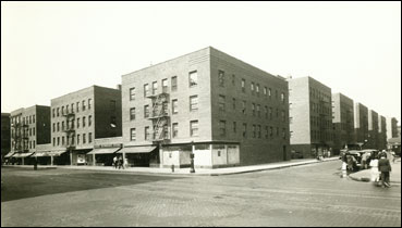
In fact the story goes that Fred French originally purchased tracts of existing tenements in the Lower East Side with the idea of tearing some down and putting up a high-end development for junior Wall Street executives.  But this was during the Depression (1931) and there was no credit to be had.  So when the RFC was created Fred French took a different tack.  He chose the worst parcels in his holding – the so called “Lung Block” for its high prevalence of tuberculosis – and proposed it to the RFC as a worthy place for slum clearance.  They agreed – ultimately lending somewhere between 85%-97% of the total $10 million cost to build.  Some 650 families were evicted and their homes torn down, replaced by twelve 13-story buildings surrounding 2 court-yards.  Despite the low-interest loan it was still a seemingly expensive project; to keep the monthly rents low the tax assessment on Knickerbocker Village had to be reduced by 2/3.  This made the monthly rent $12.50 per room (as required by the RFC); the buildings that they replaced, by comparison, had rented for about $5 per room.  So most of those evicted families weren’t coming back (but hey, that’s why we were soon to build public housing right? For the poorest of the poor?).

Aerial View Knickerbocker Village Market Monroe Cherry St. New York City

It was instead largely middle-class professionals who moved into Knickerbocker Village.  But when they did (in 1934) they found the development essentially unfinished – things like no working elevators or fixtures in the bathrooms and kitchens, and none of the promised public facilities, such as laundry rooms or play rooms, in working order.  Their complaints to the Fred French Company fell on deaf (and apparently rude and dismissive) ears.  French and co may have forgotten that they weren’t dealing with the poorest of the poor here – a large number of Knickerbocker Village tenants were lawyers and journalists – and within weeks they’d joined together to form a rent strike and a highly visible political and press campaign against the building.  It was a campaign they won, with management agreeing to repairs and reimbursements (some $25,000 in total) within 6 weeks of the rent strike.  The successful tenants were emboldened to form a permanent Knickerbocker Village Tenants Association, to undertake a program of cultural and educational activities within the development (albeit with an activist tilt).  The Fred French Company wasn’t impressed and fought back through various methods – denying meeting space, starting a rival tenants association, and ultimately declining to renew the lease of a number of tenant association leaders.  The association sued to force renewal of the leases and though they lost the court case, the move by the Fred French Company backfired – the “eviction” of these tenants caused so much sympathy that the tenants association grew to over a thousand members.  Leaders of the group would go on to help form the Citywide Tenants Council in the late 1930s – a group we’ll hopefully explore more a little later.

Because as always there’s too much to follow in one sitting here.  Knickerbocker Village was also where Julius and Ethel Rosenberg lived, before they were arrested and executed as alleged Soviet spies in the early 1950s (see what happens when you start a tenants association?).  Knickerbocker Village was also home to numerous members of the Bonanno Crime Family, including Benjamin Ruggiero, portrayed by Al Pacino in the movie Donnie Brasco (see what happens when you start a tenants association?).  And today (and for some time) Knickerbocker Village has been part of the Mitchell-Lama program, which is something I definitely want to write about someday.  And then there’s all the other things of course that don’t even have to do with housing!  I know I tend to end too many of these with exclamation points, but why not?  It’s spring again!  It’s in the 60s!  Okay, okay, calm down. I’m gonna end this one with a semicolon. ; Damn. ;

Leonard Street & Maujer Street (Williamsburg Houses)

11 Mar

There’s more I want to say about public housing.  Well actually, what I really want to do is to go through all the NYCHA developments in chronological order – but then, I want to do a lot of things. I guess I’ll just add it to the list of all the other lists I want to get around to someday: skyscrapers, churches, oldest buildings in New York, tangents related to President John Tyler (and yes, I have some really wild weekends).

But in thinking about whether public housing is a failure or not – or maybe I mean to say in rethinking the idea that public housing is implicitly a failure – I keep thinking how desperately private developers in gentrifying neighborhoods must want to get rid of them.  They’re impossible to gentrify! (Well maybe not impossible – the whole nefarious practice of selling open NYCHA land to private developers is a step in that direction, though one for the time being that’s perhaps been halted).  But still, when public housing is torn down – as it has been in numerous American cities besides New York – it’s almost never replaced by brand new 100% affordable housing.  Of course not! 100% affordable housing is terrible for people who want to make a lot of money….and kind of hand in hand with that, who hate “excessive” government involvement.  It sets a really bad precedent – a precedent that these people have been trying to kill for a long time (and quite successfully).  In these public housing replacements there’s always a mix – and often a majority mix – of market rate buildings and apartments.  There’s almost always a loss in the net total of affordable units.  Well of course again! That’s the whole point of getting rid of public housing.

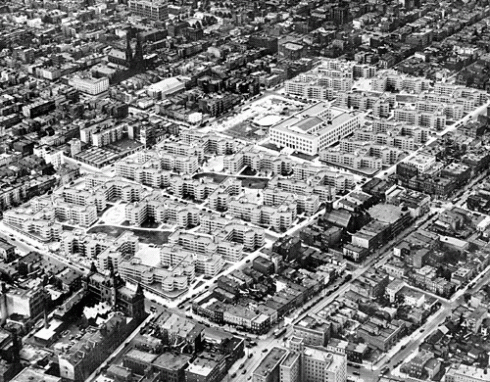
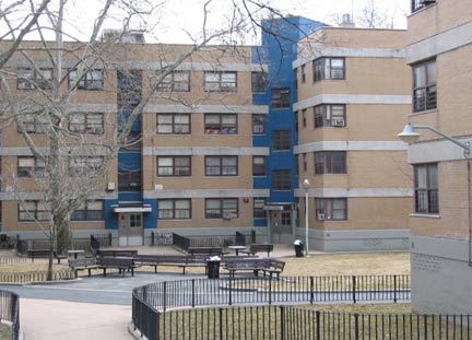
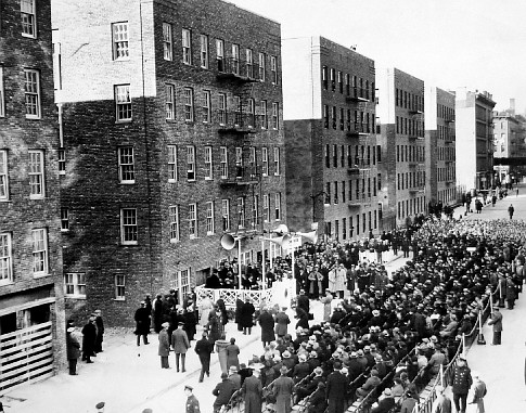
So give New York its credit: it wasn’t just the first builder of public housing, it’s also been good about not tearing its public housing down.  Hell, some of it is landmarked even – including First Houses that we talked about last time.  Another one is the Williamsburg Houses – made up of 20 four-story buildings covering 12 city blocks between Maujer and Scholes Street and Leonard Street and Bushwick Avenue.  Williamsburg Houses were begun in 1936 – just one year after the first tenants moved into First Houses – and opened in 1938, making them some of the earliest public housing projects in New York.  Unlike First Houses however, Williamsburg Houses weren’t built by the New York City Housing Authority (NYCHA) alone, but instead were a collaboration with the Housing Division of the Public Works Administration (PWA).  It wasn’t until 1957, almost 20 years after opening, that the project was turned over to NYCHA’s full jurisdiction and ownership.

m70

It’s worth noting this distinction for a moment, because it points in part towards why public housing really isn’t built anymore.  The PWA – the  builder of Williamsburg Houses – was a federal program; this was federal money building affordable housing.  What made the PWA especially unique is that it wasn’t just federal money (ie. financing) but actual direct involvement of the federal government in the planning and construction of public housing.  This was something new entirely.  Prior to the PWA the first federal agency to involve itself with housing was the Reconstruction Finance Corporation (RFC).  The RFC was created in 1932 to (among many other things) provide low-interest loans to limited-dividend housing corporations.  It only made 2 such loans though during the first two years of its existence.  So when the PWA, and its housing division especially, with its more robust involvement, came along in 1933 (as part of FDR’s New Deal – and originally called the Federal Emergency Administration of Public Works, until 1935) it represented a pretty big change. In the scheme of things its housing program was actually pretty short-lived, but in a 3 and half year period (starting in 1933) it collaborated on the construction of some 51 projects in 36 cities (though as its critics (it’s critics on the left I mean) would point out, that apparently only created some 29,000 units).  The Housing Act of 1937 (aka the Wagner-Steagall Bill), while strengthening the federal government’s commitment to housing, began to shift greater control to local authorities – returning the government’s role to essentially that of financing.

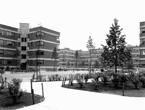
Maybe it was PWA’s influence, or maybe it was just the excitement of the early days of NYCHA but when it came time to design the Williamsburg Houses it seems they went all in.  NYCHA had a 5 person architectural board, including Richmond H. Shreve – a partner in Harmon, Lamb and Shreve of Empire State Building fame – and William Lescaze, considered one of the pioneers of modernism in American architecture.  Shreve appointed Lescaze as the chief designer for the Williamsburg Houses.  He opted for 4 “super” blocks, turned at 15 degree angles to the street grid – oriented to the sun and prevailing winds (prevailing winds?!) – and featuring a number of large and small courts that would flow into a large public space in the center of each block.  The facades were light-colored, in tan brick and exposed concrete, with entrances marked by blue tiles and stainless steel canopies.  The whole thing, though controversial at the time for its use of the “super” block, its breaking from the street grid, and its use of tan instead of red brick, was praised upon completion and has since been called by AIA, “the best public housing project ever built in New York.”

52.wburg_.houses

I don’t know – I don’t really see it, and I feel like most people would probably agree.  But maybe that’s just because I’ve successfully internalized the fact that housing projects equal bad.  I mean, these look like housing projects, ya know? (Though I have to say, they do look better in black in white – nostalgia?)  But hey, 25,000 New Yorkers applied for the 1,622 available apartments when they first opened.  That’s actually a much better ratio than the 58,832 New Yorkers who applied for the 105 “affordable” units in a new development on Manhattan Avenue in Greenpoint last year (which, of course is mainly composed of market-rate apartments – figure that those 105 “affordable” units make up 20% of the total).  So who cares what Williamsburg Houses look like – these were 1,622 affordable units built all at once.  That’s equal to 15 luxury developments that include 105 “affordable” units but otherwise drive up the rents everywhere around them every place they go up.  And that are also also ugly.  I mean personally, if I have to choose, I’ll take ugly affordable any day.  Who’s with me?

Williamsburg-Houses-1938-nycarch-1

First Avenue & 3rd Street (First Houses)

12 Feb

Should I apologize for my long absence?  Have you all been waiting by the computer for me to write?  I know a lot of bloggers out there post multiple things a day.  But hey, that means by my analysis that I’m only about 264 posts behind since last time.  Piece of cake!  Let me just take a nap first and I’ll get right on it.

There’s still so much I want to talk about!  Remember how we were starting to look at some limited equity co-ops on the Lower East Side – as a kind of warm up to looking at some of the public housing?  Well let’s look at some of the public housing!  I’ve been thinking about it.

Because you read Jane Jacobs’ The Death and Life of Great American Cities (for example) and you come away feeling like public housing in the United States has been a failure.  Which it largely has been, both in execution and in design.  I mean in its physical design, which is what Jane especially goes after: the whole tower in the park thing; separating the development from the activity of the street and so ensuring that it will be unvisited by everyone who doesn’t live there and hence (in practice) be unwelcoming and unsafe for almost everyone (eg. you don’t walk through the projects, you walk around them).  In the larger sense of its design, as in the way it was envisioned, you could argue that public housing is a failure as well – made intentionally shoddy so as not to compete with private real estate concerns.  It had to be in essence for the poorest of the poor, because if it was for the working class, or (god forbid) the middle class even, they might start thinking that they didn’t have to get a mortgage (fully insured by the federal government – don’t call that government spending though) and buy their house on the private market.  And once it was for the poorest of the poor that pretty much sealed the deal in terms of execution – namely that the execution would be poor.  Poor for the poorest of the poor.  Spend very little money on the upkeep and security, etc, and then talk about what animals these poorest of the poor are to let their living spaces go this way.

This notion of public housing being a failure goes much further than Jane Jacobs of course (who after all, published her book in 1961) – at this point it’s part of pop culture really: the projects equal bad.  But there’s a kind of a false conflation that goes on I think in this notion of the failure of public housing – namely, equating the failure in design and execution with a failure in intentions or goals.  The point of public housing is to provide affordable housing.  And public housing does this by providing large apartment buildings that are 100% affordable (as opposed to inclusionary zoning’s 20%, for example).  Now yes, these are 100% affordable apartment buildings that in many cases  need a lot of improvement in terms of maintenance and security but these are 100% affordable apartment buildings that a lot of people want to live in (in NYC the waiting list is close to 250,000 families).  So yes, again, it needs some help in the execution, but the fundamental idea is sound.  People need affordable housing.  The private market often does a bad job in providing it.  If the government wants affordable housing it should build affordable housing.  That’s what it used to do!

cornerfirsthou

And it did it first in NYC of course.  New York is home to the first public housing built in the United States – appropriately named First Houses – opened to its first tenants on Dec. 3 1935, as the first project of the newly created New York City Housing Authority (NYCHA).  The 4-5 story, 8 building development still stands on 3rd St. between First Avenue and Avenue A, with a portion running down Avenue A to 2nd St. (and yeah, I know they might not be much to look at, but hey, it’s public housing).  The project replaced a number of older tenements on the site as an act of “slum clearance” – one of the requirements of the federal funding it received. The original idea had been to only replace every third tenement with new buildings but it was soon apparent that they were all in such poor structural condition that the whole lot would have to go.  Not all the owners were happy about this, and when one contested (Andrew Muller) – on the grounds that seizing the buildings, even with “just compensation,” went against the New York State (not to mention the United States) Constitution – the case made it all the way to the New York State Court of Appeals.  The court ultimately sided with the city, in what would serve as a landmark case regarding eminent domain.

But not all of the owners were so opposed.  In fact the principal owner of the site was one Vincent Astor, son of John Jacob Astor IV, himself the son of William Backhouse Astor Jr. and Caroline Webster Schermerhorn Astor (man, even when you’re talking about low income housing it’s hard to stay away from these folks).  Vincent Astor had inherited the site – along with a massive fortune – at the age of 20, after his father died on the Titanic.  By the early 1930s he had dedicated himself to philanthropy and was looking to separate himself from the role of slumlord.  He sold his parcels to NYCHA for half of their assessed value – a purchase made possible in large part by the issuance of a tax-free 66-year bond by NYCHA that effectively established the Authority’s credit.

First Houses1

It was a big deal when First Houses opened – serving 122 families at an average monthly rent of $6.05 per room (equivalent to roughly $100 per room today).  The dedication in Dec. of 1935 was broadcast on national radio and besides the reading of a congratulatory telegram from President Roosevelt, included speeches by Mrs. Roosevelt, Mayor LaGuardia, Governor Lehman, Robert Moses (of course! he was everywhere) and a whole host of other names I want to explore someday.  There’s a lot more here I want to explore!  Can you all wait for it?  (By my analysis there are approximately 4 of you).  Take a nap and get back to me.

Hallets Point

14 Nov

Okay, let’s get back to looking back at some of my older posts – but let’s look back while simultaneously staying in the present.  Despite its ominous name, the treacherous body of water known as Hell Gate actually took its moniker from the Dutch word “helleget,” which means beautiful passage, and it looks like that interpretation is coming back into vogue today, with two major developments slated to go up along Hell Gate’s shores, on Hallets Point.  It’s a little hard to keep the two of them straight, which is which, (and anyway that’s what Curbed is for right?) though at the same time it’s kind of fascinating to try.  I mean, this is what the “real world” is all about right?  Really complicated legal and financial arrangements that require a boatload of money and legal representation and political connections to bring to fruition?  Though have you noticed how it’s always the people that have boatloads of money and legal representation and political connections that want to tell you how that’s the real world – something the rest of us couldn’t possible understand?  Well, sorry to tell you, but everythings the real world people!

Anyway, whatever.  The two developments are known as Hallets Point and Astoria Cove.  The Hallets Point development was conceived by Lincoln Equities, though the Durst Organization recently bought a 90% stake in the project, so it seems like they’re in charge now.  The development will include some 2,404 new units (483 of them “affordable”), plus all the requisite public trade offs like open space and public schools (since, you know, government isn’t allowed to build those kinds of things anymore) and has already been approved by the City Council.  Astoria Cove is an Alma Realty project totaling some 1,723 units.  There was some hope among its critics that the City Planning Commission would reject the Astoria Cove project unless it included more than 20% affordable housing, but that didn’t come to pass.  When I started writing this it was still up in the air whether the City Council would approve, as the local councilman (Costa Constantinides) was opposed, and the City Council tends to (though not always) follow the lead of the local councilperson in these matters.  But it turns out just yesterday the Council’s Land Use Committee approved the project, with Constantinides’ support, so it seems like it’s a done deal.  The project is amongst the first to run into the city’s new rules regarding new developments in medium to high density areas that have been up-zoned (that is, rezoned to allow for more square footage) – namely that they have to include at least 20% affordable housing, and that there will not be city subsidies to make that happen (though tax abatements, yes, are still in action).

astoria-covefinal

So there’s a rendering of one of them – Astoria Cove I think – though honestly it could be Hallets Point, or any other waterfront development taking place in the city.  I know that this city is always changing, and I know I’ve said as much before, but at the same time it’s kind of my problem with developments like Astoria Cove and Hallets Point and really pretty much all the giant projects getting built these days: they all look like each other and they don’t look like New York City.  Seriously!  I mean, sure, the trees are nice.  I’ve asked this question before I think, in a less coherent way, but I wonder of the people who want to live in these developments, why do you want to live in New York City?

So anyway, whatever again.  I was thinking it would be interesting to look into these various developers who are involved: Lincoln Equities, Alma Realty, and especially the Durst Organization (as I believe they’ve been around the longest) but I’m already pretty tired from trying to look at all this “real world” stuff – so let’s look at some old history instead.  It seems so much cleaner doesn’t it?

Hallets Point takes its name from the Hallet Family – owners of a large estate along the shores of Hell Gate (in present day Astoria) from at least as early as 1655.  That date is known because it was the year their house was burned to the ground by Indians (part of the short lived Peach Tree War? who knows!).  The estate was founded by one William Hallet, an Englishman (born in 1616) who emigrated to Bridgeport Connecticut no later than 1647 (and maybe well before) before moving to Long Island with his wife and two young sons.  After their house was burned downed they settled in Flushing, where William was appointed sheriff in 1656.  That same year he was also fined and briefly imprisoned by the New Netherland Director-General (and all around dictator) Peter Stuyvesant – who, you might recall from last time – was still fresh from his conquest of the Swedish colony of New Sweden in present day Delaware (the Swedish in Delaware! Not quite as well known as the Pilgrims right?).  William Hallet was imprisoned for allowing the Reverend William Wickenden of Rhode Island to preach in his house.  Wickenden was a Baptist, and by preaching in the colony was breaking Stuyvesant’s ban on practicing any religion in the colony outside of the Dutch Reformed Church (ooh, I wonder how the Dutch Reformed Church differs from Presbyterianism, aka the Reformed Church).  And I thought the Dutch were supposed to be known for their religious freedom.

William Hallet didn’t stay imprisoned for long at least; at some point later in his life he moved back to an estate along Hell Gate – dividing it between his two sons – William Jr. and Samuel – in 1688.  William Jr. went on to have ten children himself and presumably divided his land between some of them.  The eldest, William Hallet III, had his own estate in the area when he was murdered in 1708 – along with his wife and their five children – by two of his slaves (back when slaves made up about 18% of New York City’s population).  The murders were apparently in retaliation for Hallet not allowing his slaves to “go abroad on the Sabbath day,” though I’m sure the fact that they were, you know, slaves probably had something to do with it.  The culprits were caught and executed after being “put to all the torment possible for a terror to others.”  That didn’t stop a full on slave rebellion from taking place some 4 years later in Manhattan however, in 1712, when nine (white) people where killed in the uprising – leading to the execution of over 20 slaves in response.

1712_Slave_Revolt_burned_at_the_stake_NYC

So anyway, just some cheery thoughts as you’re moving into your new development.  Enjoy the trees!